
The Neighborhoods of Ortigia
The old town of Syracuse is represented by the island of Ortigia, whose architectural appearance is predominantly from the eighteenth century due to the earthquake of 1693 that destroyed almost all previous buildings. The urban plan of Ortigia derives from a Greek plan, later modified over the centuries according to the needs of the time. It extends on the intersection of the two main axes: the first from north to south from Tempio di Apollo, throught via Dione e via Roma, and the second transversal to this from east to west, from via della Amalfitania e via della Maestranza.
The different areas that compose the island of Ortigia will acquire over time a different political configuration, which has led to a differentiation of architecture and management of space, but especially to a different productive destination. The main areas, especially from the Middle Ages, acquired an autonomous character both from a cultural and social but also economic and productive point of view and can be summarized as follows:
– the north-east area of the Giudecca and Spirduta, represents the district of fishermen and traders;
– the north-west area of the Bottari district represents the artisans’ district;
– the south-east area of the Giudecca district represents the Jewish quarter;
– the south-west area of the district of the Duomo and the Castle, represents the noble district.
The neighborhoods took on different destinations and names over the centuries, depending on the domination of the time, so part of the area of Spirduta and Graziella was called the Mastrarua or in other times was used the name of the Maestranza, and the area between the Giudecca and the Duomo was also called Turba.
ften the fishermen’s neighborhoods of the maritime cities are given the name of Graziella, a sign of devotion to the Madonna delle Grazie, to whom many icons, sculptures and votive shrines are dedicated in the neighborhood.
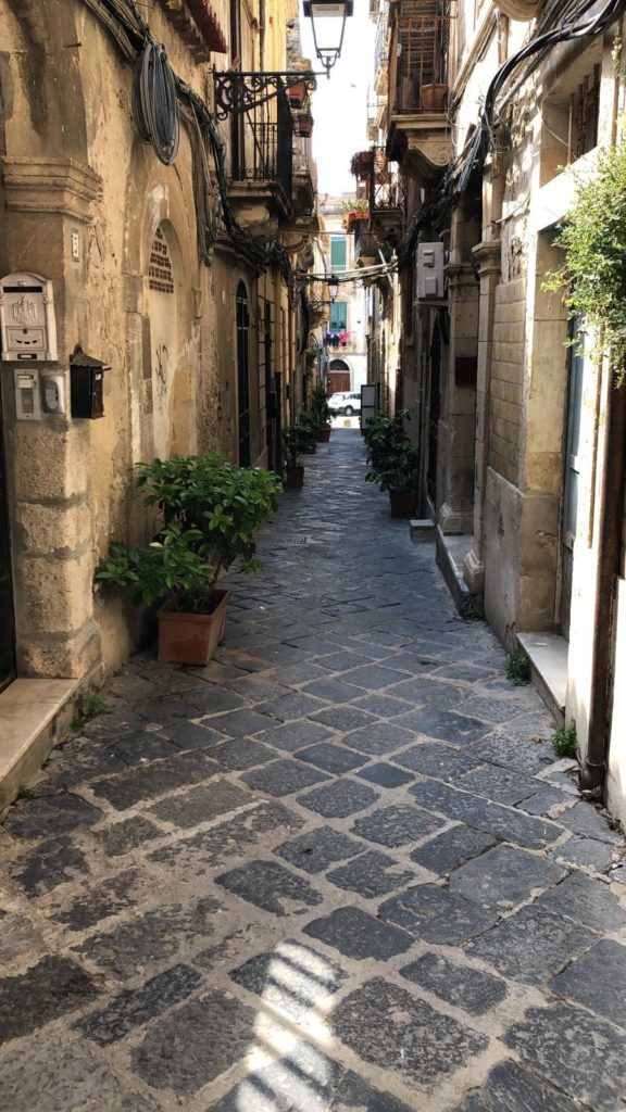
Like all the districts of Ortigia, it has undergone transformations, demolitions and additions over the centuries. More than the other districts, the Graziella and the Spirduta have suffered the destruction of the Arab conquest, without benefiting from the urban reorganization that the Norman and Aragonese conquerors will carry out later. It still preserves a clear urban fabric of Islamic origin, with narrow streets and courtyards, whose fascinating labyrinth still retains its original function of mitigating the heat and violence of the winds.
This is where the beauty of the 13th century Arab Siracusa
resided, when baths, mosques and markets of the famous Maghreb ceramics were built around the disappeared Marieth castle. Islam has remained present in the local culture: some Arab fishing methods, linguistic forms and gastronomic recipes survive, such as the famous timbale, whose name derives from the Syracuse Emir Tummah.
La Graziella covers a triangular area between Via Resalibera, Via Dione and Via Vittorio Veneto.
The route of the minor roads is winding and rich in branches, which develop into “ronchi” and courtyards.
Even the system of “ronchi”, small blind roads interrupted by buildings, is attributed to Arab culture and has been preserved especially in the east of Ortigia. Probably they were used to achieve greater spaces of domestic intimacy outside the dwellings, often small, damp and devoid of light. The “ronco” becomes an extension and part of the house itself, as a necessary space for the expression of daily life and social contacts. It was there that people would meet to mend their nets.
This intimacy and familiarity is still tangible while walking through the “ronchi” of the Graziella, passing through the open doors of the houses to give light and air to the buildings, listening to the neighbours discuss with each other.
The Syracuse “ronco” is divided into three types: obtained in the courtyard of a previous building, then short and wide and well-lit; short and linear, so very narrow and damp and poorly-lit; long and winding, wider and airy, characterized by branches that lead to inner courtyards or lead to barrage buildings. This cluttered structure was born and developed without any rules, spontaneously and neglecting functionality, but it represents the charm of the neighborhood.
La Graziella has undergone several urban transformations, some of which are particularly significant.
The increase in defensive architecture has led to the destruction of some districts around the Temple of Apollo and the construction of the tower Casanova in the place referred to as Talèo, now called Thales. The same area was again modified under the Bourbon rule with the construction of the central prison and the Palazzata of via De Benedictis, which involved the demolition of the houses of the Bagnara borough.
The most incisive demolition was carried out in the 1930s, during the fascist regime, with the construction of Via del Littorio, now Corso Matteotti, which led to the destruction of four entire blocks of the ancient medieval city.
The Spirduta neighborhood is bordered to the north by the fishermen’s district, to the east by Via Gargallo, to the west by the Bottari and is confined to the south by Via della Maestranza.
It has had both a commercial and residential destination, which gives it a hybrid and unusual appearance. On the one hand it houses beautiful aristocratic residences, such as the XV century Palazzo Gargallo in Gothic-Catalan style, with an imposing external staircase and a spacious colonnade; on the other hand it houses smaller and less interesting houses, originally with a lower floor adapted for commercial purposes and the upper floor for residential use.
After the earthquake of 1693 this district also assumed, like the rest of the old town, a baroque character. The post-unification destruction and bombing of the Second World War contributed to distort its medieval image.
The Spirduta, as well as the Graziella, has an intricate and cluttered urban structure, typical of the Arab organization, which helps to make it an equally characteristic neighborhood.
Via della Maestranza is still today the most dynamic and active area of Ortigia and has maintained the structural and functional conditions of its architecture, without suffering the partitions and transformations that have upset many other areas. The Maestranza is the most representative, elegant and scenic area of the island, with the baroque face of its noble buildings and the urban composition that made it the main axis. Its importance is due to its function as an axis of urban connection from east to west, followed by its subsequent function as a residential road with mainly noble buildings. The architecture features a baroque character, starting with the reconstruction after the earthquake, rich in scenic effects, majestic shapes and imaginative decorations.
On the previous fifteenth-century buildings rise the new monumental buildings, for which they were looking for the most valuable stones and the most skilled architects and craftsmen.
With the settlement of the Jewish community, the street took on the peculiarity that it has never lost, both residential and commercial. Their economic activities developed between the district of Giudecca and Spirduta, so via della Maestranza was the central axis that put them in direct communication with the Porto Grande.
The building has lent itself to this dual use by allocating to the craft shops the lower floor, characterized by high and deep rooms, and the large internal courtyards of the buildings. The upper floor housed the residences of the most illustrious families of the Arezzo aristocracy.
Visiting Via della Maestranza on foot, with your eyes looking high, means letting yourself be captivated by the emotions and sensations of an ancient era.
It borders the neighborhood of Spirduta, on the east side that leads to the sea, the district of Mastrarua, which takes its name from its main street.
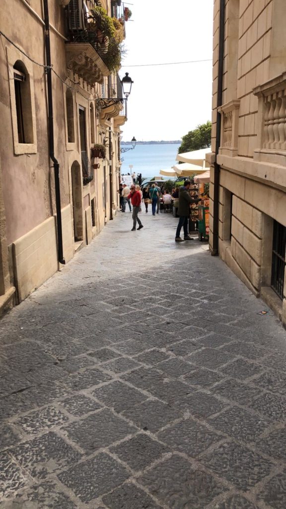
Via Mastrarua, now Via Vittorio Veneto, has been defined the main street par excellence of Catalan times and is certainly, along with Via della Maestranza, the most beautiful and interesting street in Ortigia. They were in fact the two arteries that presented the city to kings, viceroys, men of arms who came to Syracuse.
Its route is long and varied and its destination has been different from the neighboring districts of Graziella and Spirduta, of which it was part. The Mastrarua with the Spanish domination ceased to be a fishermen’s road, but welcomed the bourgeoisie of the time, assuming a residential and representative function prior to the advent of the Baroque.
The monumental noble palaces with their luxurious entrances and decorated balconies, transformed and tampered with in the following centuries, are evidence of this development.
The first section, from via della Maestranza to via Mirabella, is wider to allow movement and traffic of the carriages. It also houses the palaces of the noble families of Syracuse, masterpieces of civil architecture, such as Palazzo Blanco and Palazzo Interlandi. It is in this stretch that you will also find the majestic church of the Congregation of San Filippo Neri, with its white and bright facade.
The monumentality of the buildings is reduced, until it disappears, in the second stretch that goes from via Mirabella to largo Forte San Giovannello. This part is more similar to the nearby Graziella, with small and short buildings, narrow and dark alleys and architectural clutter.
The residential units follow the same evolution: the inner courtyard adapts its function, from a community space in which the doors of the tiny houses open, to a inner courtyard for the palaces of greater proportions.
The district extends east of Corso Matteotti to the marine and is characterized by the narrow streets that hinge on the main axis of Via Cavour, the old Via dei Bottari.
Since the Middle Ages it has been home to the shops and guilds of merchants of various nationalities, which is why it is called the “district of craftsmen”.
It owes its appearance to a different aspect from that of the other districts, economically related to the commercial and craft activities of the nearby Porto Grande and the marine, as the toponymy of the area reminds us.
The commercial activity was characterized by a strong associative nature, a bond that bound the workers to the guilds and confraternities, according to the various conditions, arts and crafts.
While production was concentrated in this area, sales took place everywhere, in the streets, in the shops, in the squares inside and outside the walls, in Piazza del Duomo and in the marine area.
The typical accommodation had the twin function of residence and workshop, so the ground floor was the huge intrados that served as a warehouse and shop (putia in Sicilian), and upstairs stood the residence completely independent, which was accessed via an external staircase.
Even at the Bottari many buildings have foundations and valuable elements dating back to the thirteenth – fifteenth centuries, such as Palazzo Abela in Via Cavour or Palazzo Lanza in Via della Amalfitania, which preserve the original external appearance.
Contrary to the urban “ronchi” junction, typical of the districts of Graziella and Spirduta, here the road elements are streets and alleys.
The commercial fortune of Syracuse developed during the fifteenth century had a decline in the following centuries, becoming a military stronghold and therefore unable to maintain its trading with foreign countries. The commercial activities, as well as the ancient brotherhoods and congregations of trades, shut down and abandoned the premises. The Spanish fortifications helped to condition and block the development of the district from the sea side and forced the flourishing economy of Syracuse to fall back on itself in a process of involution.
After the earthquake of 1693, baroque buildings were built on the small shops and on the ancient intrados of the numerous confraternities, embellishing the prospects of the modest houses, far from the sumptuous baroque, and changing the structure of the district.
From an architectural and urbanistic point of view, it is difficult to trace the Jewish or Arab-Muslim component in the fabric of Ortigia. The Jewish community has been present in Syracuse since the Roman domination. During the Arab invasion, Jews were allowed to worship freely.
The Normans gave a strong setback to the liberality of Muslims and aimed at the affirmation of Christianity for purely political reasons. With the new rulers, discontent grew until it resulted in real riots.
In 1312 Frederick II of Aragon separated them from the Christians, assigning them the large area of Acradina outside the walls, near the actual basilica of San Giovanni. Inside the ghetto the Jews had their services and their social roles. They were thus marginalized, offended and subjected to strict taxes.
In 1450 King Alfonso of Aragon recognized the contribution that the community gave to the commercial and artisan life and granted the community to move into the city in the area between Via della Maestranza and Via Larga, now Via della Giudecca.
From the urbanistic point of view, the Giudecca district overlaps with the Greek urbanization, leaving substantially unaltered the ancient road layout, which had divided Ortigia into four quadrants obtained from the intersection of the two main axes. In turn, each area was divided into large rectangular insulae by minor roads.
Here the Jews reused the old medieval structures by inserting their services and cult sites: the synagogue, the purification baths, the hospital and their shops. The synagogue probably stood within the perimeter of the present church of San Filippo under which it is assumed there were other purification baths, such as those of the White House in Via Alagona.
Despite all this, the Jewish community enjoyed great economic prosperity. The main street of via della Giudecca was packed with shops and frequented by the Syracusans themselves who bought fabrics and leather. Two wide open spaces allowed the stop and the negotiation and, through the nearby via della Maestranza, there was a direct and immediate contact with the big port.
The whole district was characterized by the many and often monumental religious buildings surrounding it, which were in contrast to the smaller civil buildings and humble dwellings.
With the ecclesiastical constructions the religious orders wanted to oppress the ghetto by demonstrating their hegemony and buffering the encroachment of the ghetto in other areas.
The earthquake of 1693 destroyed everything, forcing the Syracusans to rebuild almost completely, both religious and civil architecture.
The Turba is an area close to the sea, bordered by the Giudecca district on one side and the Duomo area on the other, and runs along the second stretch of Via Roma.
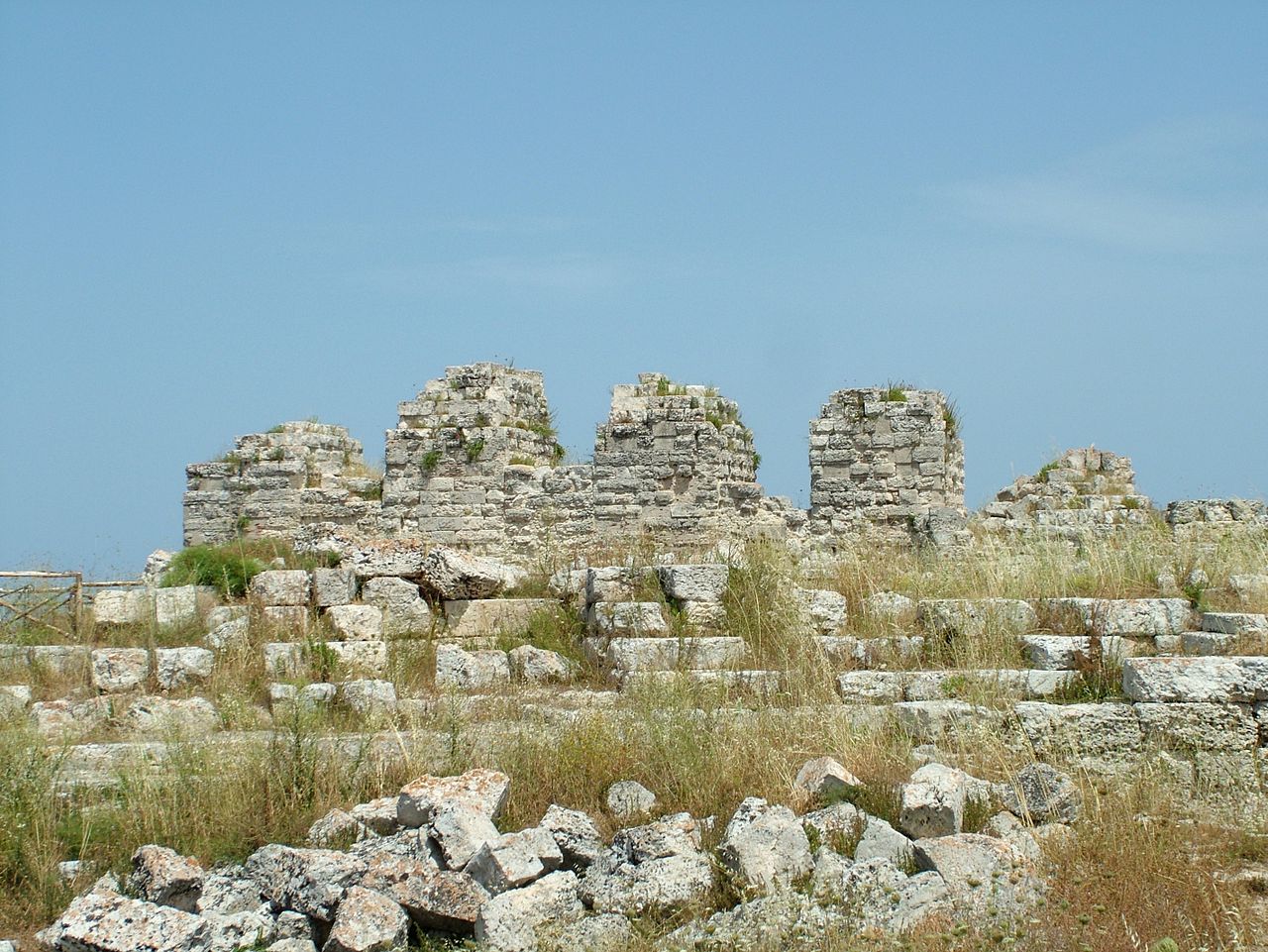
We have reports of this name during the bishopric of Mons. Giovanni Antonio Capobianco (1649-1673) who, as Vicar of the Val di Noto, fortified Ortigia in several places. His work is responsible for the current walls of the Turba built with square blocks of white limestone.
This part of the old town has the same urban and structural characteristics of the Giudecca, with small houses and without hums and courtyards. In this area, unlike the Graziella, the houses are not projected outwards, but close in their limited internal space.
Only on the side of Via Roma is the character more sought after, close to the noble areas of the historic center, with larger houses and different construction characteristics.
The district of the Maniace Castle is located at the point where the island narrows and stretches out to the sea. The district is enclosed on two sides by the sea, on the north by via Capodieci and on the south by the Maniace Castle with its military buildings.
The district is not characterized by a homogeneous social layer or a reference activity, but it has merged together the residential, economic, commercial and military character. Its architecture is not homogeneous and, starting from deep medieval memories, presents a stratification of styles that have followed one another over time. The palaces, including the grandiose Palazzo Bellomo, stand out for their magnificence, while via del Castello Maniace offers the best Syracuse Baroque. The surrounding building housed the artisan and popular life, in fact the whole area had a productive and commercial character.
The far end of the promontory had probably been used in every age to house military constructions. The Maniace Castle made the area the most advanced point of the complicated defensive system of the 16th-17th century stronghold. The size of the castle, the battery on water level, the ramparts were intended to charm the visitor or the enemies who came from the sea.
Piazza del Duomo is the urban hub of Ortigia, the center of history, culture and art of Syracuse. There have been no events or vicissitudes that have not occurred in the square, to which it has not offered its spaces.
The area covered by Piazza del Duomo and Via Minerva is the central and highest point of the island: here the first data on human presence are already from the Neolithic period and the first settlements date from the Bronze Age. This area was the heart of the Greek city, of the medieval city and especially of the baroque one, characterized by a noble architecture mixed with religious architecture.
The area of the Duomo has always been used a place of cult, from the huts in honor of prehistoric deities, to the Greek temples. The Greek urban planning that ploughed the soil of Ortigia with long axes, was intended to outline and highlight this sacred area, home of the main religious structures of the city.
On this large area the prospect of the Byzantine basilica had been included when the ancient Greek temple was remodelled. Christianity had for a few centuries decentralized the attention from the square to the hills of the Teracati district. In the sixth century the bishop’s seat was transferred from the one outside the walls, which was too exposed to the raids of the brigands, to the ancient Greek temple, after having made the appropriate adaptations. In this way the ecclesiastical presence has perpetuated the sacred vocation of the site that goes beyond the prehistoric, Greek and Roman cultures to get strongly to the Christian one.
From this moment began a slow and progressive appropriation of the square that over time will change appearance: the religious feasts converged with the triumphal carts, the markets of fine goods, will concentrate the most representative building that will consecrate the area and the surrounding zone to residential district par excellence.
The baronial aristocratic power could not avoid the flattery of showing off their wealth and between the mid-fourteenth and four hundred were born the best achievements of Aragonese and Catalan architecture. Between the seventeenth and eighteenth centuries the square assumed its current configuration: bishops and lords promoted the construction of churches and aristocratic residences all around the Cathedral and the Bishop’s Palace.
For the architectural revival of the eighteenth century, engineers, architects and master builders of proven ability were called upon to work, giving the square a strong Baroque setting.